What accident reconstruction data is available from Map view?
What is Accident Data?
Once a collision occurs the accelerometer within the GO device will detect an accident event and record second by second data of the accident and re-transmit this data for interpretation. This includes Latitude, Longitude, speed, accelerometer as well as various other information that are essential to reconstructing the accident event.
How do I interpret Accident Data?
There are various tools available within MyGeotab that can be utilized to interpret the raw data from the device. For the purposes of this document the below information are accident reconstructions of two real accidents that occurred.
Reconstruction of Accident Data
Case 1: GO7
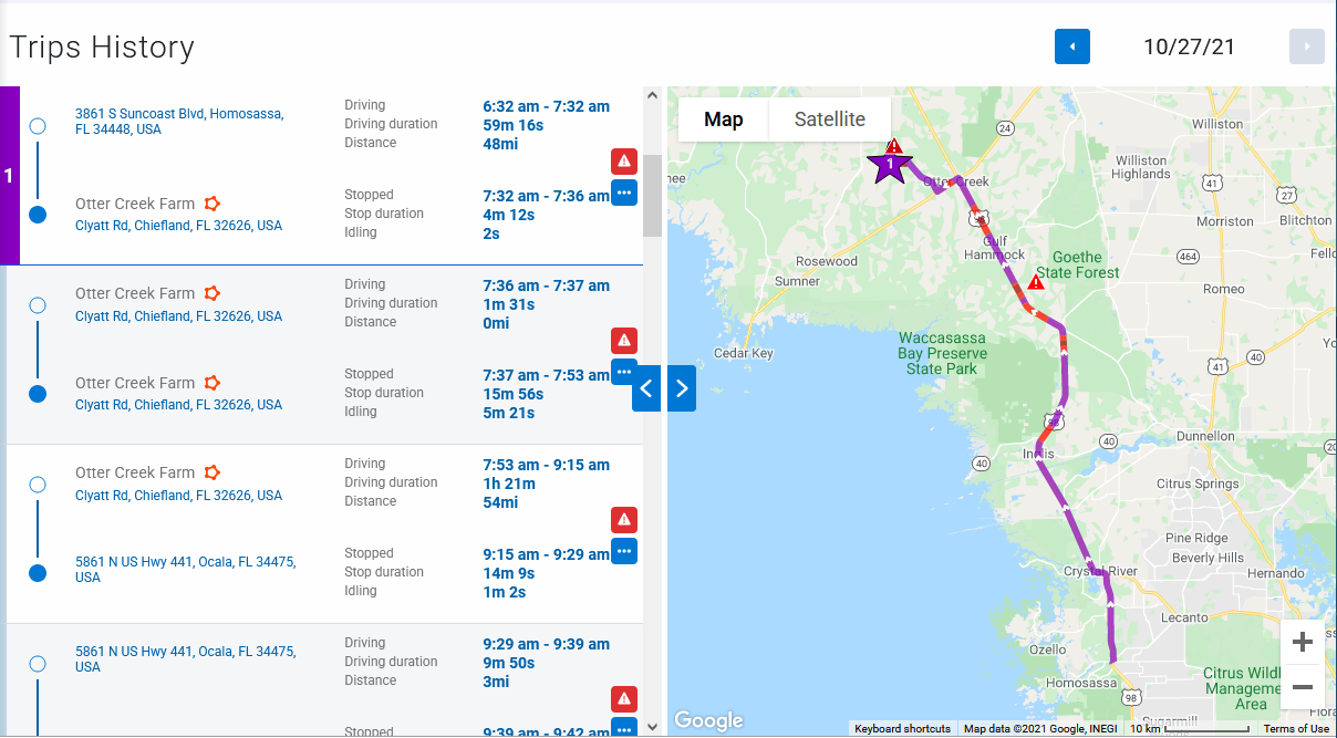
Map View
The first step to reconstructing accident data is to view the accident on trips history. This can be done by clicking on Map>Trips History. Choosing the date and the time of when the accident occurred will show that trip on the map. One of the first things to note is that the initial few seconds after the ignition event is usually inaccurate since the device will still be attempting to find the GPS latch. In the image below this vehicle was hit from the side as it was trying to pull into the main road. The map alone should not be the only tool used in the reconstruction as it does not show enough information.