How does Geotab manage posted speed limits?
Compare your driver’s speed with the posted road speed for local city driving, or within specific zones such as schools or other low speed residential areas. Easily watch changes in style depending on the environmental conditions.
Compare your driver’s speed with the posted road speed for local city driving, or within specific zones such as schools or other low speed residential areas. Easily watch changes in style depending on the environmental conditions.
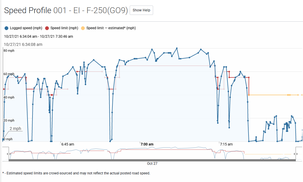
The speed profile is accessed from the Trips History for a vehicle. Open the Map by clicking the option in the left menu. Click Trips History button above the map. Select the desired vehicle and trip day. Click the ... button located on the extreme right of the window and select Speed Profile from the menu.
Customers who use the hosted version of Geotab have access to real world posted road speeds. This allows street level accurate notifications to be sent when driver’s exceed local speed limits. Posted speed limit data comes from two sources: NAVTEQ Maps Open Street Maps (OSM) Note: Posted road speed is only available to customers who use the hosted version of Geotab and is supported in the U.S. and Canada. Posted road speeds can change frequently and may contain inaccuracies. You can update the posted road speed of any road by clicking on a road from the live map. A menu will appear, select Update posted road speed to change the value. Geotab shares the changes you make to posted road speeds with all customers. That way, everyone benefits from each others changes. On a monthly basis, Geotab will send the latest posted road speeds to OpenStreetMaps, where they will make them available to everyone else on the Internet. Note: Due to the possible inaccuracies caused by road construction or other hazards. We recommend that posted speed limits be used as part of a larger safety strategy. For the latest coverage maps from the above data sources see http://goo.gl/W0xxj7.
Vehicle acceleration
Geotab offers the ability to set exception rules for excessive driving behaviors such as harsh acceleration, harsh braking and harsh cornering. Depending on the type of vehicle the rule is applied to, use the table below as a guideline for the average g-force exertions typical to that vehicle. In most cases, the default values found in Geotab are suitable, but are highly customizable.